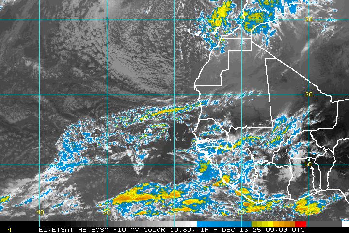
We are watching the tropics closely as an area of low pressure could become our first tropical system of the year off the African Coast. Now this system is still a long way from affecting any area of the United States and would be at least a week away from entering the Gulf of Mexico if it does develop. We are seeing a strong ridge of high pressure over the central Atlantic and this would help steer the tropical system south and possibly move into the Gulf or Caribbean. Again it is a long way away but it is never too soon to start thinking of a “Plan of Action” if this system holds together and moves into the Gulf.
The 2009 Atlantic Hurricane Season has been very quiet so far this year but it only takes one storm to make a quiet tropical season turn into a destructive tropical season. This year’s hurricane season is very similar to the 1992 Atlantic Hurricane season. Like 2009, the 1992 hurricane season started of very quiet thanks in part to an El Nino weather pattern causing variations in the jet stream we normally do not see this time of the year. It is these variations in the mid and upper level winds that have sheared apart any tropical low before the system could strengthen to tropical storm or hurricane strength. On August 14th, 1992 a tropical low moved off the African coast and began to strengthen. As it moved west, it encountered very warm waters and light atmospheric winds allowing it to become a tropical depression and finally a named tropical storm. The name this storm was given was Andrew.

In case you don’t remember, Andrew became only the 3rd category 5 hurricane to strike the United States and was the costliest natural disaster to effect the United States until 2005 when Katrina hit the Gulf Coast.
The atmosphere over the northern Atlantic is very similar to the set up we saw in mid August 1992. A strong ridge of high pressure is dominating the central Atlantic Ocean and this will help keep the tropical system on a westward track, making a North American landfall more likely. Long range computer models currently track this system west and eventually turn the system to the north along the Eastern United States Coastline. It must be noted however we are still at least seven days away from this system being a threat to the Atlantic or Gulf Coasts of the United States. Many changes can and probably will occur before then so stay tuned for the latest information.

No comments:
Post a Comment