
One year ago today a tornado outbreak began across East Texas and proceeded to spread across much of the Mid South and Southeast. Before the outbreak ended, 87 tornadoes touched down causing 5 deaths and injuring 146 people.

The day began with a moderate risk of severe weather across parts of Arkansas and a slight risk across most of East Texas and Louisiana. Across East Texas, the threat was very conditional, meaning if the storms were to develop, they would rapidly become severe but there was still a chance no storms would form at all.
Well, the storms did develop and ended up producing large hail and 5 tornadoes across East Texas.
Fortunately for us, very few injuries were reported and no fatalities occurred. It was a different story across other areas of the south where one tornado in Arkansas killed 3 people.
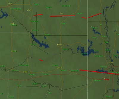
One of the most interesting aspects of this event was in Southwest Arkansas where an anti-cyclonic tornado struck near Centerpoint. This tornado was rated an EF-2 and had a damage path of up to a half mile, very large and strong for an anti-cyclonic tornado.

Now anti-cyclonic tornadoes are not unheard of, but what is interesting about this one was the unusually large size. The storm that produced this tornado began as a part of the supercell which produced three tornadoes in Cass County. This cell split and the left mover remained as strong as the right mover. The left mover showed anti-cyclonic circulation for around 30 minutes before the half mile wide tornado touched down.
You can read more about this event from the Nation Weather Service in Shreveport
here.


 This will set the stage for severe storms to develop out to our West late Friday afternoon and move east into East Texas Friday evening and overnight. At this time it appears there will be plenty of instability and wind shear to keep these storms at severe levels through the overnight hours. The atmosphere will be conducive for very large hail, strong gusty winds, and isolated tornadoes. Remember we are still four days away from this developing storm system and a lot could change between now and then. Severe weather outbreaks require many ingredients to come together at once. Any difference in timing could cause these storms to be weaker or stronger. Below is an outlook for severe weather on Friday. This is NOT an official forecast. The Storm Prediction Center does have most of East Texas outlooked for a 30% or greater chance of severe weather Friday. The outlook below is based on the 0Z model runs and can and probably will change between now and Friday. For those used to SPC outlooks, do NOT use the colors on this outlook to determine slight, moderate , and high risk areas. I have enhanced an area in red where I feel the greatest risk of severe weather will take place on Friday. I do believe we will see a moderate risk of severe weather issued for Friday.
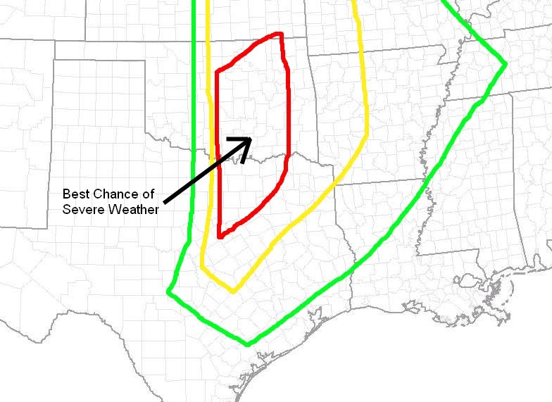
 You may have heard on the news that a powerful cyclone hit Northeast India Tuesday Night killing over 100 people. In actuality what appears to have hit this area of the world was a tornado. This area of the world is no stranger to severe weather and tornadoes, many times called cyclones in this part of the world. Based on archived satellite images it does appear a broken line of strong thunderstorms, possibly supercells, developed as moist southerly winds off the Bay of Bengal were forced vertically along the front range of the Himalayan Mountains. I do not know for sure if these were indeed true supercells as the nearest Doppler radar site is over 400 km away and I could not find any archived data. Based on the latest information from the Regional Meteorological Center in Alipore a tornado did indeed move across Northeast India from the northeast corner of the Bihar State into West Bengal. Top winds were estimated around 125 km/hr or78 mph which would be an EF-0 tornado in the U.S. Lack of warning and poor construction can be attributed to the loss of life, over 120 at last count, many of which lived in mud shacks.


