
So what happened? At 4 AM most of East Texas was under clear skies except for the extreme southern counties. Our wind was out of the northwest around 15 mph moving over a deep snow pack to the north dropping our temperatures into the middle teens in most areas. Many of our East Texas lakes are oriented from northwest to southeast, parallel to the wind flow. This maximized the available moisture fetch available. Now the greatest fetch of wind over water this morning was about 20 miles. So heavy snow is not expected however, if there is a great enough difference from the water and air temperatures, moister will rise off the lake and form very low clouds, almost appearing like steam fog.
Well, this morning we had an average of 30°F difference from the lake temperature to the air temperature. This is more than enough of a difference needed to cause moisture to rise for lake effect snow. Usually you look for a difference of 13°C or about 23°F. The surface wind speed usually needed to produce a lake effect snow event is between 10 and 40 mph. Our wind speed was on the lower end which actually helps the air mass acquire the moisture needed to produce snow down wind.
This is a radar shot from the Shreveport NEXRAD that shows two snow bands that developed this morning.
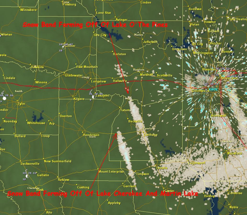 Both of these bands developed off of the warmer waters of nearby lakes. The other bands that developed this morning were too far away to be detected by radar but could be seen from space.
  Notice the cloud streaks that formed downwind from all of the area lakes this morning.
So next time you see a big weather story in Buffalo, NY showing you how many feet of snow fell remember, we here in East Texas got a little taste of what our neighbors to the north have to deal with many times a year.
No comments:
Post a Comment