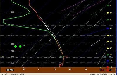
We could see a strong storm or two as we do see a little elevated instability this evening. The main threat would be small hail and a few gusty winds.

Today’s system will drive a dryline/cold front through the area early tomorrow. With clearing skies and gusty west southwesterly winds, high temperatures will reach the middle 70s tomorrow afternoon.
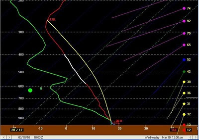
Another potent storm system is currently diving down the Pacific coast this morning and will swing across the Southern Plains Wednesday. This system will have much warmer air to work with along with higher amounts of moisture. At this time it appears there is a fairly good chance of seeing severe storms Wednesday including isolated tornadoes. The Storm Prediction Center currently has the Eastern two thirds of East Texas under a slight risk of severe storms on Wednesday. If the trends continue to look the way they do I look for at least our Eastern Counties to have an upgrade to a moderate risk for severe storms. Right now it looks as though scattered supercells will develop east of I-35 around noon Wednesday and move east. These storms will have the potential to produce large hail, damaging winds, and tornadoes. As strong forcing catches up to these storms I look for a squall line of severe storms to form late Wednesday afternoon increasing the threat for damaging winds across our Eastern Counties. As with all severe weather events, a lot could change between now and Wednesday but is does appear there is a chance of a significant severe weather event Wednesday afternoon and evening.


No comments:
Post a Comment