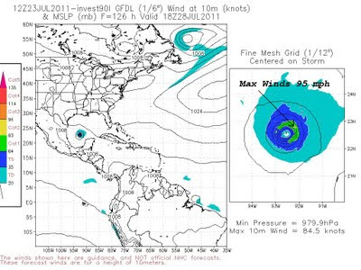


Tropical forecast models were hinting at a developing tropical system a couple of days ago. Some of the high resolution models were showing a strong tropical storm or hurricane by Friday morning. If this were to happen the storm’s name would be Don. Right now the models have backed off on this development but it will be interesting to watch. It seems as though this disturbance has become a little better organized the past 24 hours. This could be just what East Texas needs, a tropical system moving to our south but close enough to send in lots of tropical moisture increasing our chance of rain. If this system takes a more northerly track we could see locally heavy rain over the weekend.

If it moves farther south, East Texas would be mostly dry and very hot. Right now it appears the second scenario is more likely but we will continue to watch this developing system.

No comments:
Post a Comment